Municipal Statistics
On this page:
Population
Number of inhabitants
as per 09 June 2020:
- Inhabitants total: 28,073 – of which 14,315 male and 13,758 female
- Persons with principal place of residence in Leoben: 24,398
- Persons with secondary place of residence in Leoben: 3,675
- Households total: 13,740
Geographic data
Location:
Geographic position: 47° 23′ northern latitude, 15° 6′ eastern longitude
East-west extension: 16.8 km
North-south extension: 16.1 km
Altitude and highest elevation
Average altitude above sea level: 540 m
Highest elevation: 1,643 m (Wetterkogel)
Lowest point: 515 m (residential building Proleber Straße 142)
Tallest building: 58 m (church tower of Waasen parish)
Rivers and streams
Mur, Gössbach, Schladnitzbach, Vordernbergerbach, Karrenbach
Area and perimeter
Perimeter of urban area: 53 km
Total area: 107.77 km2, of which
- 69 % woodland
- 03 % agricultural land
- 27 % building land
- 50 % other
- 19 % waters
- 84% Alps
- 48 % gardens
Cadastral communities & street/road names
Community data
Municipality: Municipality number 61108
Capital of the district of Leoben
ZIP code: 8700, telephone area code: +43 3842
Number of street/road names: 249
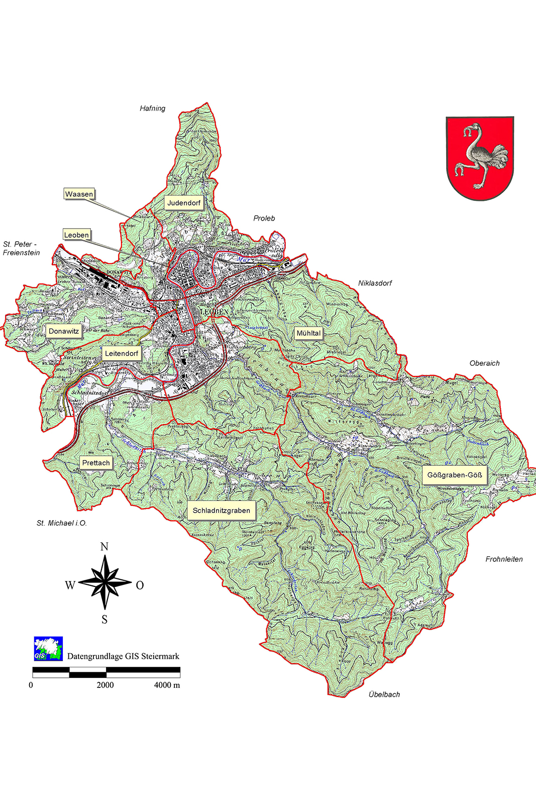
Leoben is comprised of ten cadastral communities:
- Donawitz
- Göß
- Gößgraben-Göß
- Judendorf
- Leitendorf
- Leoben
- Mühltal
- Prettach
- Schladnitzgraben
- Waasen
Network of roads and streets
Leoben has an extensive network of roads, streets, cycle paths and bridges:
- some 190 km of roads and streets; of which 100 km paved
- 130 kilometres of footpaths
- more than 15,000 m2pedestrian zone in the centre of town
- some 80 bridges
- some 30 km of cycle paths
- some 4,000 street lights